We love big bold questions. Synthesising data over large spatial and temporal scales and bringing together information from different sources to support our findings. Along the way, we have our trusty SuperShrub (our mini-supercomputer), but there are some things even SuperShrub can’t handle, or can’t do in the most efficient way. So how can one extract NDVI, land cover, climate data and more over thousands and thousands of kilometers and across many, many days, months and years? Why with the Google Earth Engine!
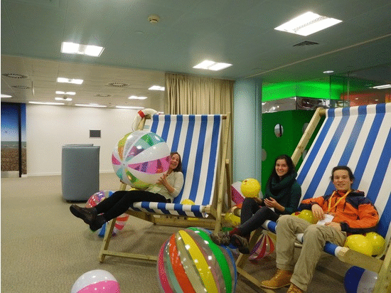
Last week, Isla, Jakob, Sam and Gergana headed to London to attend a training workshop led by Noel Gorelick and Nick Clinton. A rainy morning in London with travel delays for some and generally long train rides for all wasn’t a particularly promising start, but it turns out we were off to the beach. We escaped the cold and rain at the Google Academy, where there was a strong beach theme, with colourful beach balls, giant beach chairs and even sand and faux sea grass in the corners of the room. With dreams of working with MODIS, Landsat, Hansen data and more, we were ready to tackle JavaScript and see how we can use the Earth Engine to expand our research horizons. And what did we learn??? Read on to find out.

The Earth Engine is fast. Very fast!
Gergana: Being able to quickly access and extract land use information for thousands of locations around the world is a key part of my PhD research on the drivers of biodiversity change. I had heard the Earth Engine is fast, and I knew that one of the datasets I am working with, the Hansen et al. Forest Cover Database, is accessible through the engine, but I am also stubborn and I love R! So many a day were spent trying to push R and SuperShrub to their limits… and well, the code never finished running, as I stopped it after a week of waiting! That is why I was pretty excited to see the Hansen database mentioned in the presentation prior to the workshop, and I couldn’t wait to try extracting information. I adapted some of the code we learned in the workshop and a bit of code I found online, and what do you know, 42 seconds (only 42 seconds!) later, I had a csv with thousands of rows specifying the forest loss and gain in 2001-2014 for the areas I was interested in. Amazing!

The Earth Engine is flexible!
Isla: In a one-day workshop, we covered a lot of ground – from pixel classification, spectral unmixing to phenology analyses. We had a chance to explore the greening of our focal field site Qikiqtaruk – Herschel Island all the way up to the greening of the Arctic! We knew that the Earth Engine was a powerful platform, as some of us had dabbled before, but it is great to finally get a better understanding of what the possibilities are. The Earth Engine could be a game changer for earth observation. Below you can see MODIS NDVI trends for our focal research site all the way up to the Western Arctic at 1 km resolution, all calculated in under 10 minutes. You can see pixels with active coastal erosion and permafrost thaw slumping getting browner and the less disturbed tundra vegetation getting greener at the local scale and the patterns of greening and browning in the Western Arctic region.

Taking time out of our usual routine to learn new things is important.
Team Shrub recently met to discuss our New Year’s resolutions, and one of our general life goals – “to keep learning new things” – was pretty high up on that list. It’s not always easy to make time for new things in our busy lives, but sometimes it is just something that you have to make happen. Even if it involves taking many trains and feeling motion sick on every single one! As much as we love coordinating Coding Club and teaching students quantitative skills at the University of Edinburgh, it’s also nice to be the one being trained and getting to attend a coding workshop from time to time!
So, for Team Shrub, harnessing the power of the Earth Engine might allow us to expand our horizons from scaling from plots to landscapes to the entire tundra biome and to quantifying the drivers of biodiversity change around the planet. And now that the training is over, we can’t wait do dig in deeper and explore our earth observation research questions in a whole new way.
By Gergana and Isla

2 thoughts on “Our Google Earth Engine adventure”